Drishti Aerial is a leading provider of professional drone solutions, delivering innovative and efficient aerial services across various industries. Equipped with cutting-edge drone technology and operated by skilled professionals, Drishti Aerial specializes in providing precise and reliable solutions tailored to meet client needs
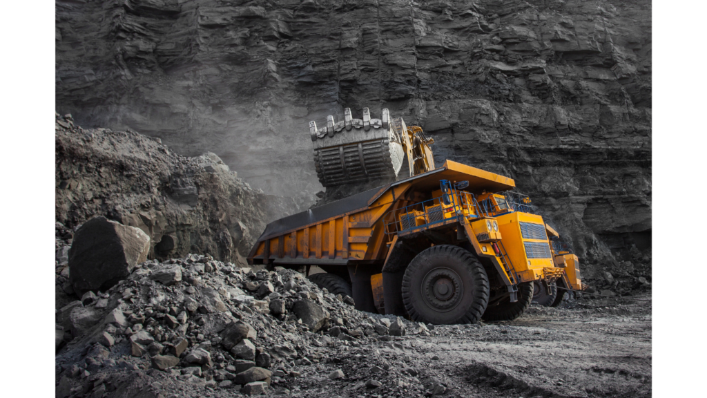
Mining & Geological Services
Leverage high-resolution drone imaging for resource exploration, mine safety assessments, and excavation planning. Drones deliver real-time data, enabling precise mapping of mining sites and ensuring accurate resource identification. They improve site efficiency and enhance worker safety by accessing hazardous areas without risk, allowing for faster decision-making and optimized operations.
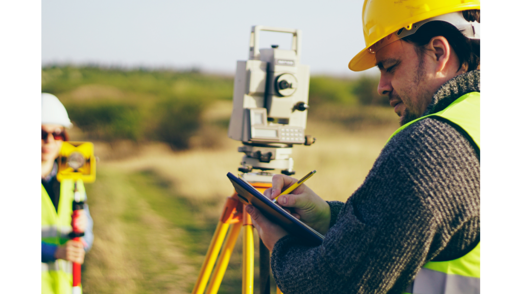
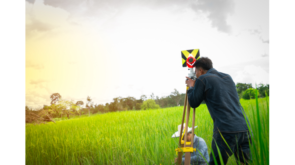
Land Survey & Planning
Conduct precise aerial surveys for land development, infrastructure planning, and environmental assessments, using high-resolution imaging and advanced mapping techniques. Drones capture detailed insights, enabling efficient project execution by providing accurate data on topography, land use, and environmental conditions. This technology streamlines planning, minimizes risks, and ensures better decision-making, leading to faster and more effective project delivery.
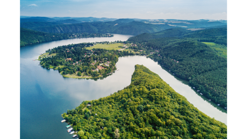
River Mapping
Utilize drone-based river mapping for accurate data collection in mining replenishment studies, integrating remote sensing, field surveys, and advanced mapping techniques like GIS, DEMs, and hydrological modeling. Drones provide high-resolution imagery and real-time data to monitor river conditions, sediment transport, and water quality, supporting sustainable mining practices. These insights help in planning resource replenishment, assessing environmental impacts, and improving overall mine management for long-term ecological balance.
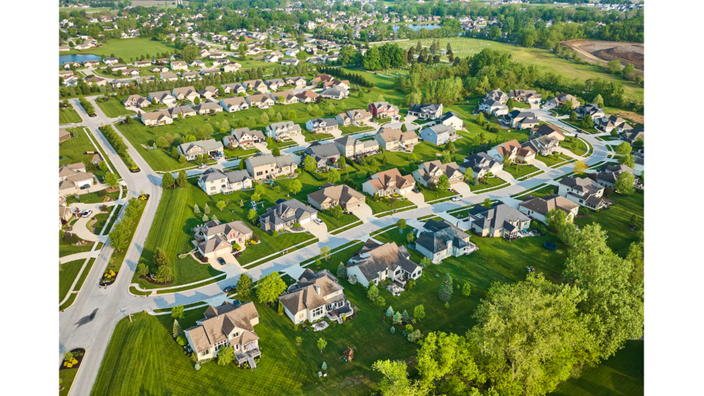
Property Demarcation
Ensure legal compliance and accurate land registration with high-precision drone surveys that deliver clear, reliable property boundary data. Drones capture detailed aerial imagery and GPS coordinates, providing precise measurements for property boundaries and reducing the risk of disputes. This technology streamlines the surveying process, enhances efficiency, and ensures reliable documentation for land ownership, making it an essential tool for real estate, legal, and development projects.
Solar Plant Inspection
Boost the efficiency and performance of solar panels with thermal imaging drones that provide rapid fault detection and optimization. These drones quickly identify hot spots, damaged cells, and performance issues, allowing for timely repairs and minimizing energy loss. By offering detailed thermal insights, drones help optimize the operation of solar power systems, ensuring maximum energy output, reducing maintenance costs, and extending the lifespan of solar panels
Agricultural Survey
Harness the power of drone technology for efficient crop health monitoring, soil assessment, and irrigation planning to maximize agricultural yields. High-resolution imaging and multispectral sensors enable early detection of crop stress, nutrient deficiencies, and pest infestations. Advanced soil analysis helps optimize land use, while aerial irrigation mapping ensures precise water distribution, reducing waste and enhancing productivity. By providing real-time insights, drone surveys empower farmers to make data-driven decisions, improve resource efficiency, and increase overall farm profitability.
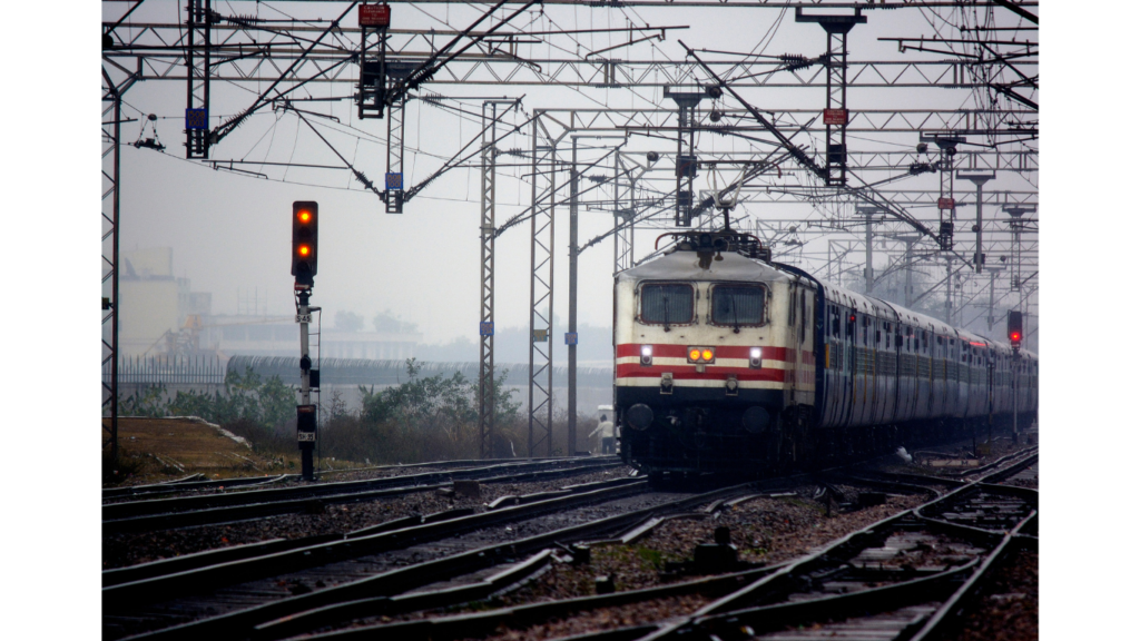
Railway Services
Leverage drone mapping for precise inspection of railway tracks, bridges, and tunnels, ensuring safe and efficient operations. High-resolution imaging and thermal sensors help detect structural weaknesses, track misalignments, and potential hazards in real time. Drones provide rapid, cost-effective, and non-intrusive monitoring, minimizing downtime and reducing risks for inspection crews. By delivering detailed aerial data, drone-based railway inspections enhance maintenance planning, improve operational efficiency, and support long-term infrastructure sustainability.
Industrial Inspection
Utilize drone technology for visual inspections of industrial sites and equipment, reducing downtime and improving maintenance efficiency. High-resolution imaging and thermal sensors enable early detection of wear, corrosion, and structural issues, preventing costly failures. Drones provide safe, rapid, and non-intrusive monitoring of hard-to-reach areas, minimizing risks for personnel. By delivering real-time data and actionable insights, drone inspections optimize maintenance schedules, enhance operational efficiency, and extend equipment lifespan.
Forest & Wildlife Survey
Harness the power of drone technology for monitoring forests, wildlife populations, and habitat changes, aiding in conservation efforts. High-resolution aerial imagery and thermal sensors provide real-time data on deforestation, illegal activities, and ecosystem health. Drones enable non-intrusive tracking of wildlife, helping researchers study migration patterns, population dynamics, and endangered species. By delivering accurate and timely insights, drone-based monitoring supports sustainable conservation strategies, enhances environmental protection, and ensures the long-term health of natural habitats.
Our Journey
From humble beginnings to soaring heights, Drishti Aerial has been on a mission to revolutionize industries with cutting-edge drone technology. Driven by innovation, passion, and a commitment to excellence, we’ve transformed visions into reality, one flight at a time.
Happy Client
0k+
Aerial Filming
0+
Aerial Photos
0
Satisfaction
0%
More Service Options
Aerial Photography & Videography:
Explore how drone-based imagery enhances marketing, real estate, and event documentation.
Aerial Photography & Videography:
Surveying & Mapping
How drones are transforming the surveying and mapping industry with precision and cost-effectiveness.
Surveying & Mapping
Inspection Services
The advantages of using drones for inspecting hard-to-reach places like rooftops, powerlines, and construction sites